|
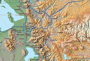 MOUNTAIN HIGH MAPS® USA RELIEF - Digital Shaded Relief and EPS Geo-Political Maps of the US states - two collections: 31 states in the Eastern collection, 19 states in the Western collection. Each USA RELIEF stte map is a set of 4 full color shaded relief maps and one grayscale relief map sized between 50-500 MB at 100 meter per pixel resolution. Any of the four interchangeable topographic base relief maps (high-contrast, low-contract, natural look, and cartographic styles) can be overlayed with the state editable EPS vector data including coastlines, rivers, interstate / major roads, railroads, county, state and international borders, town locations, town names text and latitude/longitude grids.
 Eastern USA - 31 states EPS Illustrator geopolitical maps + five styles JPEG relief maps $49 Eastern USA - 31 states EPS Illustrator geopolitical maps + five styles JPEG relief maps $49
Western USA - 19 states EPS Illustrator geopolitical maps + five styles JPEG relief maps $49
ALL USA - 50 states EPS Illustrator geopolitical maps $29
Product Information |
Technical Specifications for Individual State EPS Map and Map Package
|
|
 MOUNTAIN HIGH MAPS® - CONTINENTAL EDITIONS AMERICA - Version 4.0
The unique MOUNTAIN HIGH MAPS® collection of relief maps is available as a separate products for the designer who only requires a smaller selected group of continental maps. The map specifications are identical as for the full Mountain High Maps Edition, including political, vegetation & elevation relief maps and two base grayscalerelief maps JPEG and TIFF Photoshop images along with overlaying vector Illustrator editable EPS map.
MOUNTAIN HIGH MAPS® - CONTINENTAL EDITIONS AMERICA - Version 4.0
The unique MOUNTAIN HIGH MAPS® collection of relief maps is available as a separate products for the designer who only requires a smaller selected group of continental maps. The map specifications are identical as for the full Mountain High Maps Edition, including political, vegetation & elevation relief maps and two base grayscalerelief maps JPEG and TIFF Photoshop images along with overlaying vector Illustrator editable EPS map.
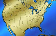
USA Mountain High Map #204
EPS Illustrator geopolitical maps + five styles JPEG relief maps $19
American Continent Mountain High Maps - 16 maps
EPS Illustrator geopolitical maps + five styles JPEG relief maps $29
Product Information |
Technical Specifications
North America |
USA map |
Eastern USA |
Central USA |
Western USA |
North-Eeast USA |
Alaska |
Hawaii
|
|
USA Relief and Vector Map package
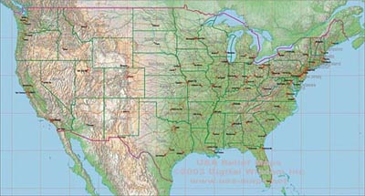
This package includes 5 very large USA Relief texture maps at approx 300 meter resolution showing land relief sized at 14,400 x 7,720 pixels, giving a printed size of 96 x 48 inches at 150 dpi, or 48 x 24 at 300 dpi. Any of these 5 maps can be used with the Illustrator EPS vector map shown to build a composite USA map with geo-political features. The bottom layer of the Illustrator layers palette is used to place the artwork, and the transparency may be adjusted to screen down the background relief texture. Any Illustrator layer may be selected, edited for color and thickness or removed to build a map view to your specification.
Illustrator vector layers include coastlines, rivers, interstate & major roads, railroads, county, state and international borders, town locations, town names and state name text and latitude/longitude grids.
USA 300 meter resolution Relief and Vector Map package
USA EPS Illustrator geopolitical map + five styles JPEG relief maps $19
Product Information
|
|
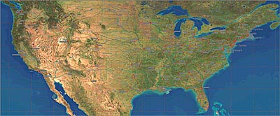
USA Satellite Image and Vector Map package
This package includes a very large USA Satellite image at 1,000 meter resolution showing land relief sized at 7,560 x 3,120 pixels, giving a printed size of 50 x 21 inches at 150 dpi, or 25 x 10 at 300 dpi. The area covered by the satellite image map runs from 24º North to 50º North, and from 64º West to 127º West. The satellite image map can be used with the Illustrator EPS vector map to build a composite USA map with geo-political features including coastlines, rivers, interstate & major roads, railroads, county, state and international borders, town locations, town names and state name text and latitude/longitude grids. The bottom layer of the Illustrator layers palette is used to place the artwork, and the transparency may be adjusted to screen down the background satellite image texture. Any Illustrator layer may be selected, edited for color and thickness or removed to build a map view to your specification.
USA Satellite Imagery with EPS Vector Map - package $19
|
|
 COOLMAPS® USA collection of 250 ready-to-use royalty-free USA maps, each volume created specially by a team of graphic designers, featuring an imaginative array of dazzling and dramatic, artistic, thematic, textured and special effects views of the USA suitable for many media publishing applications. Styles include: Black & White 12; Blends 12; Outline 32; Flags 10; Technology 31; Art 15; Fabric 6; Metal 19; Paper 13; Stone 10; Textile 2; Wood 5; Regions 6; Time Zones 5; Water 3; Miscellaneous 13; States 20; Spheroids 16; Perspective 25, and includes masks to remove the land from backgrounds. Rights allow almost unlimited commercial use. COOLMAPS® USA collection of 250 ready-to-use royalty-free USA maps, each volume created specially by a team of graphic designers, featuring an imaginative array of dazzling and dramatic, artistic, thematic, textured and special effects views of the USA suitable for many media publishing applications. Styles include: Black & White 12; Blends 12; Outline 32; Flags 10; Technology 31; Art 15; Fabric 6; Metal 19; Paper 13; Stone 10; Textile 2; Wood 5; Regions 6; Time Zones 5; Water 3; Miscellaneous 13; States 20; Spheroids 16; Perspective 25, and includes masks to remove the land from backgrounds. Rights allow almost unlimited commercial use.
COOLMAPS USA JPEG 250 USA Views collection in JPEG format $19
Product Information & Technical Info |
CoolMaps Catalog
|
|
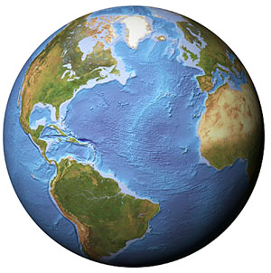 EARTH IMAGES COLLECTION is a collection of 3D globe views and maps created from Satellite Images, a highly realistic image of the Earth's surface derived from thousands of Earth observation satellite images. Data from 3 satellite systems were combined with digital map and terrain data to produce the natural color Satellite Image. Earth-Images comprises 8 variations of Globe Views - Clouds, Clear sky, Night Sky and Ocean floor texture, all with the optional white background or black background - 1,179 total images including over 100 images of the USA at 5,000 meters per pixel resolution. Each image is at 22.5º increment North or South, East and West to give complete coverage from any perspective. Also included a selection of world views focused on 3 different areas in 3 styles, and a collection of Continental Views taken from 6 locations in 3 styles each. For details see www.earth-images.com EARTH IMAGES COLLECTION is a collection of 3D globe views and maps created from Satellite Images, a highly realistic image of the Earth's surface derived from thousands of Earth observation satellite images. Data from 3 satellite systems were combined with digital map and terrain data to produce the natural color Satellite Image. Earth-Images comprises 8 variations of Globe Views - Clouds, Clear sky, Night Sky and Ocean floor texture, all with the optional white background or black background - 1,179 total images including over 100 images of the USA at 5,000 meters per pixel resolution. Each image is at 22.5º increment North or South, East and West to give complete coverage from any perspective. Also included a selection of world views focused on 3 different areas in 3 styles, and a collection of Continental Views taken from 6 locations in 3 styles each. For details see www.earth-images.com
Earth Images Collection - 1,000+ Globe Views
JPEG Satellite Images of the World from every angle $19
Product Information |
Technical Specifications
VIEW EARTH IMAGES CATALOGS:
Clear view 1 |
Clear view 2 |
Cloud cover 1 |
Cloud cover 2
Ocean floor 1 |
Ocean floor 2 |
Night lights 1 |
Night lights 2
|
|
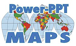
USA POWERPOINT MAPS Digital Wisdoms collection of Mountain High Maps for PowerPoint® Presentations is available for Buy Now. Each set of maps is delivered as a Microsoft PowerPoint® PPT format file and can be easily and speedily edited within PowerPoint® application to create a map with a wide number of impressive variations to meet your presentation needs. Options are available for individual PPT maps, elevation relief, vegetation relief and political color fill versions, or a bundle of all three versions. Go to Map Catalog to view download options.
POWERPOINT MAPS 250 map collection in PPT format $9
Product Information |
Catalog
|
|
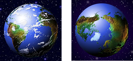 GLOBESHOTS® is a distinctive collection of high quality relief globe images with enhanced 3D effect. This superb resource of 100 high resolution (300 dpi) TIFF RGB and 164 low resolution (72 dpi) PICT/BMP colorized globes show the world in 5 general categories and 39 specific viewpoints - equatorial, polar, strategic, oceanic and continental. The Relief Globes are presented in a range of styles and colors, with and without cloud cover, with masks and artwork to reconfigure the globes with interchangeable foregrounds and backgrounds, including blends, halo and star effects. Masks are provided to remove the globes from their background and provide shading effects. To view the complete catalog of globes and review product information and licensing details see www.globe-world.com GLOBESHOTS® is a distinctive collection of high quality relief globe images with enhanced 3D effect. This superb resource of 100 high resolution (300 dpi) TIFF RGB and 164 low resolution (72 dpi) PICT/BMP colorized globes show the world in 5 general categories and 39 specific viewpoints - equatorial, polar, strategic, oceanic and continental. The Relief Globes are presented in a range of styles and colors, with and without cloud cover, with masks and artwork to reconfigure the globes with interchangeable foregrounds and backgrounds, including blends, halo and star effects. Masks are provided to remove the globes from their background and provide shading effects. To view the complete catalog of globes and review product information and licensing details see www.globe-world.com
GlobeShots Collection - Globe Views $19
Product Information |
Technical Specifications
|